
North American Hydrogen Hydrogen Infrastructure
Station Type
-
All North American H2 Infrastructure
-
Gas Station
- Car / Light Duty Truck
- Bus
- Truck
- Rail
- Research Facility
- University
- Military
-
Production & Distribution
- Production & Liquefaction
- Production Gas
- Transfill
- Underground Storage / Other
- Manufacturing
-
Gas Station
Map Legend

Planned Public Hydrogen Refueling Station

Open Public Hydrogen Refueling Station

Planned Private Hydrogen Bus Refueling Station

Open Private Hydrogen Bus Refueling Station

Planned Private Hydrogen Truck Refueling Station

Open Private Hydrogen Truck Refueling Station

Research Facility Hydrogen Refueling Station

University Hydrogen Refueling Station

Military Hydrogen Refueling Station

Production & Liquefaction
Production
Transfill

Other Hydrogen Refueling Station

Hydrogen Station Temporarily Unavailable

Rail Station

Fuel Cell Manufacturing
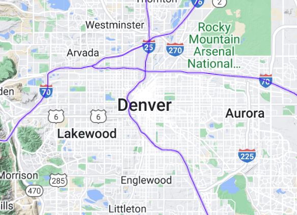
Blue polylines (like those below) represent Hydrogen Round 1 & Round 2 Alternative Fuel Corridors. Source: FHWA Office of Natural Environment, Sustainable Transport and Resilience Team.
This map of all North American hydrogen infrastructure is one of many environmental & geological survey maps made by respectmyplanet.org. More maps are in development, so keep checking back.
Check out some of RMP's other maps by clicking the links below.
RMP's Realtime Status Map of California Hydrogen Refueling Stations