

Since taking a new job in 2017 that didn’t work out super great which led to taking a new job again 2019, I haven’t had too much time to work on JavaScript & PHP & MySQL which is my favorite pass-time. Finally in 2020, especially with the cancellation of sports for the kids, I have been knocking the rust off of my coding skills. So much fun to finally start updating RMP’s maps again.
CLICK HERE TO GO STRAIGHT TO THE MAP!
I will be doing more posts & videos on how to use RMP’s environmental maps. RMP’s Hydrogen USA & Canada map and our Ann Arbor Dioxane Plume map will be the two “feature” maps as I rebuild the software throughout this year. The concept is that many parts of the maps, using an MVC structure, form a standard mapping platform that allows me to exploit the heck out of the Google Maps API and do stuff you just can’t find in those cheesy newspaper maps which cost the papers a lot of money and are still inferior. RMP will be able to show energy infrastructure & contamination remediation using a map platform that’s next level and just fun to code.
What’s New in RMP’s Hydrogen USA &Canada Map:
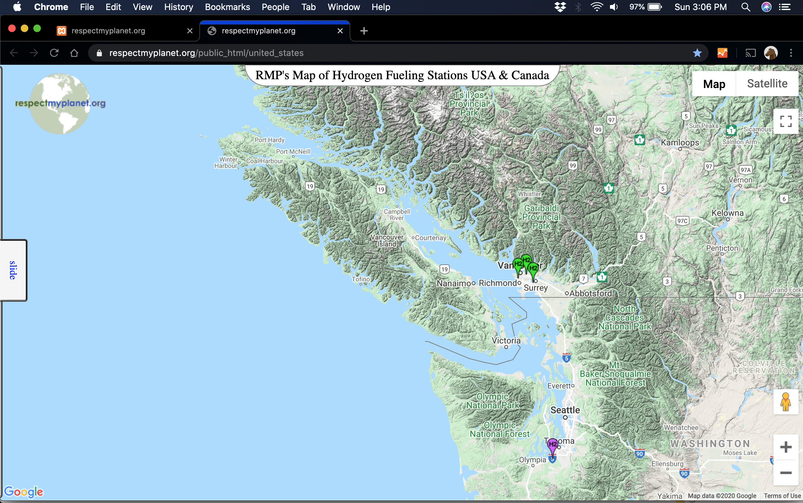
- Canadian stations have been added to Vancouver. There are two Shell stations that are public & a third station at Powertech Labs in Surrey. I reached out to Powertech Labs and Giuseppe Stanciulescu, a project engineer in their business development department, responded that the station at Powertech Labs in Surrey is currently closed to the public for major upgrades which sounds positive for when it reopens. Still working out a couple bugs on the coding to have the infowindows fire on these new locations, but I was excited so I moved them from my local computer the www. Below are a couple pictures showing the West Coast Canadian stations. See image below. Or check out RMP’s interactive Google Map by clicking here.
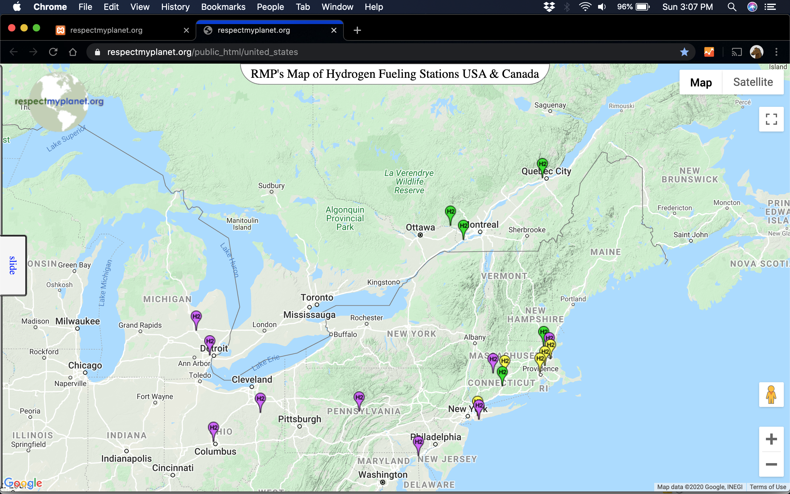
- Below is another screenshot of three new H2 refueling locations shown in Canada in the East. The Grenville Shell & the Salaberry-De-Valleyfield Shell are not listed on Canada’s new Electric Charging and Alternative Fuelling Stations Locator website but they are listed on Shell’s hydrogen fueling page. When zooming in on these stations, they don’t look built yet. The Esso Quebec City location, however, is verified on Google Street View as existing yet still doesn’t show on Canada’s website yet. See pic below or check them out on RMP’s interactive map page by clicking here.
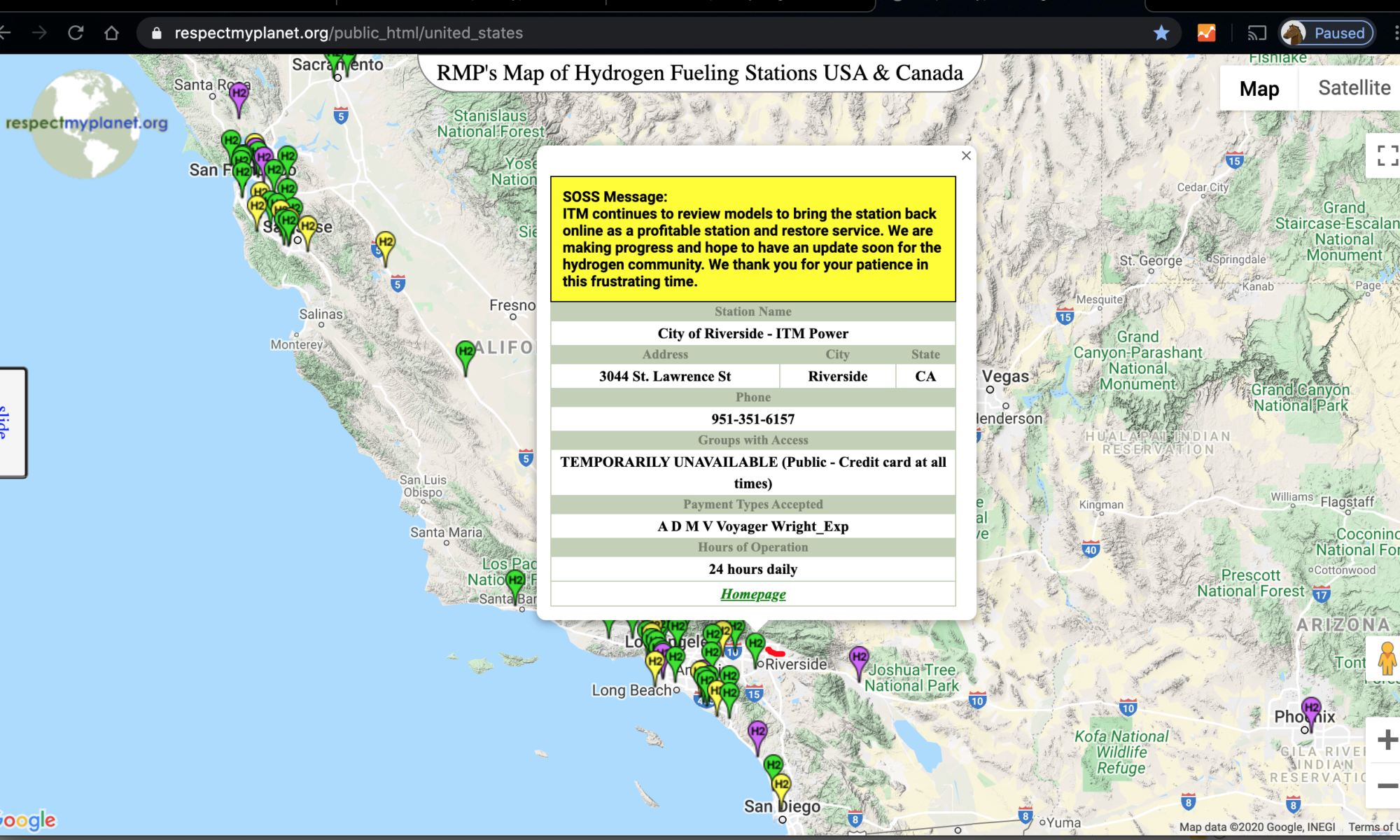
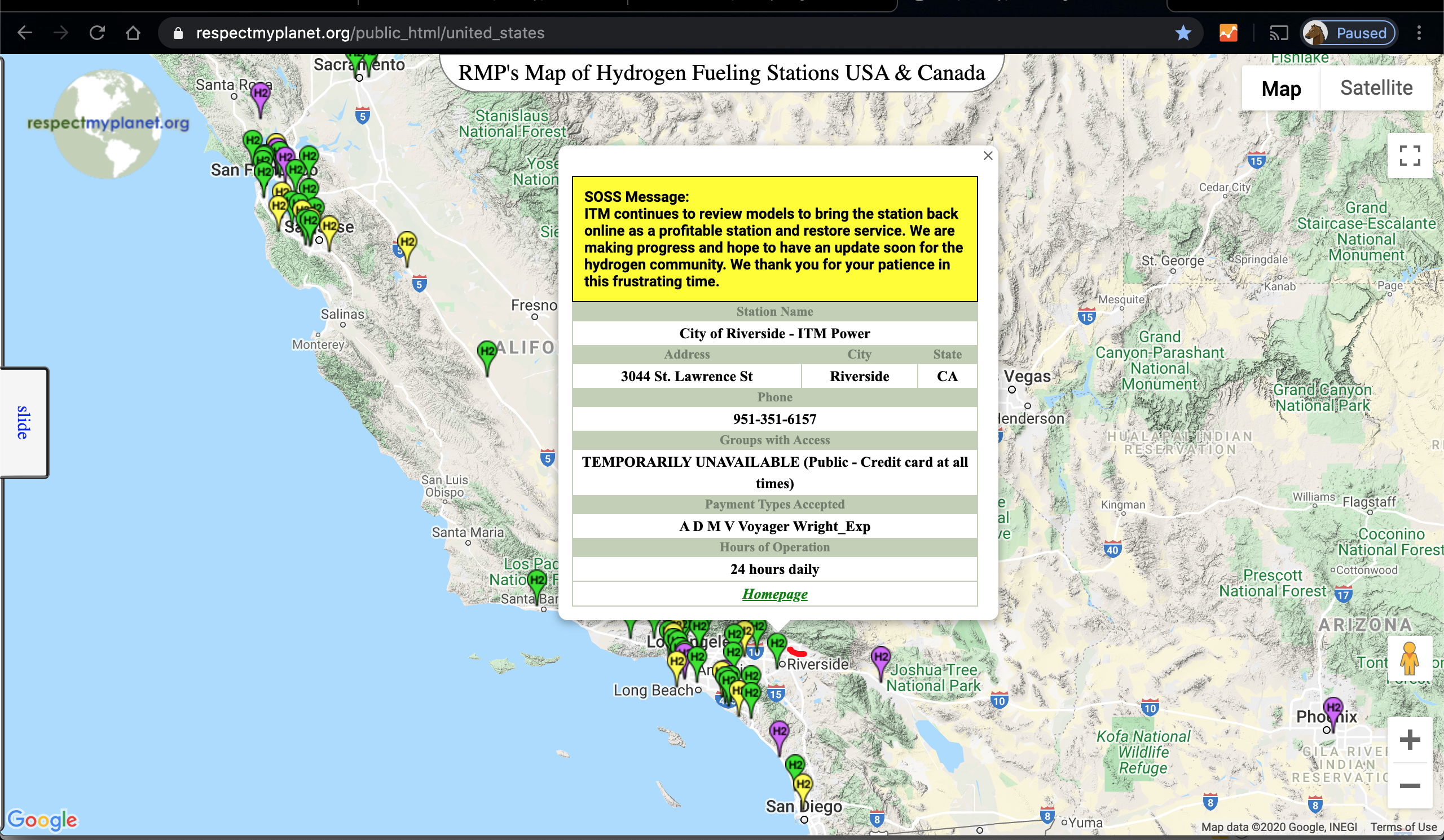
- Also added to RMP’s interactive map is a connection to CAFCP’s SOSS website for real time updating. If you look at the infowindow in the feature image of this post (also shown below) you can see that RMP’s regular infowindow now also show’s the latest SOSS message. In the pic, I obviously haven’t prettied up the message yet with formatting but I will and it’ll look really great. The functionality is what’s important. Also, note that there is a link to a “homepage” for each location. The homepage for each location gives RMP a chance to give every station it’s own “facebook” style page where pictures, news articles, YouTube videos, and other information can be stored for people (like you) that want to learn more about clean energy. See pic below or check out the interactive map by clicking here.
Just a short post to note that RMP’s interactive hydrogen map is now in phase 2 of getting some sweet updates. By our quarterly report at June 30, 2020, I hope to have a ton of cool new features. You’ll be able to see more locations too. RMP already has the Redlands Passenger Rail line mapped in San Bernadino, but we have a lot more locations to truly show the infrastructure across North America. RMP will be adding hydrogen production plants, liquefaction locations, transfill locations, and more truck & bus locations.
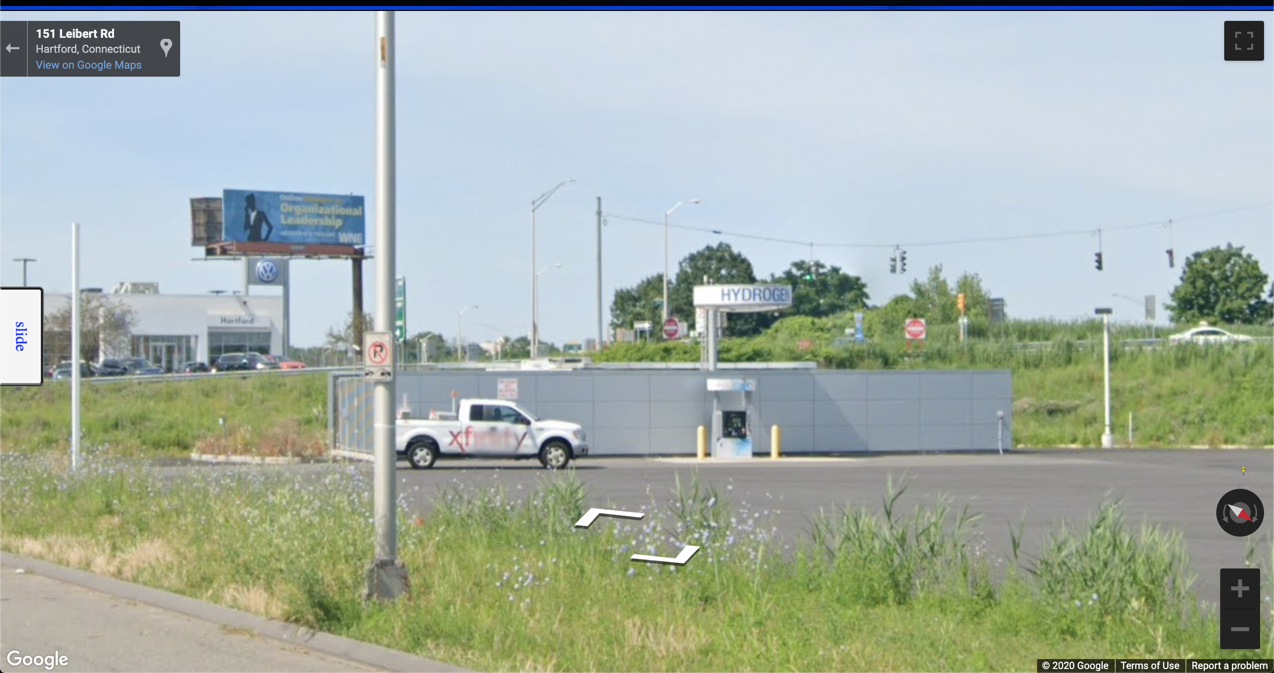
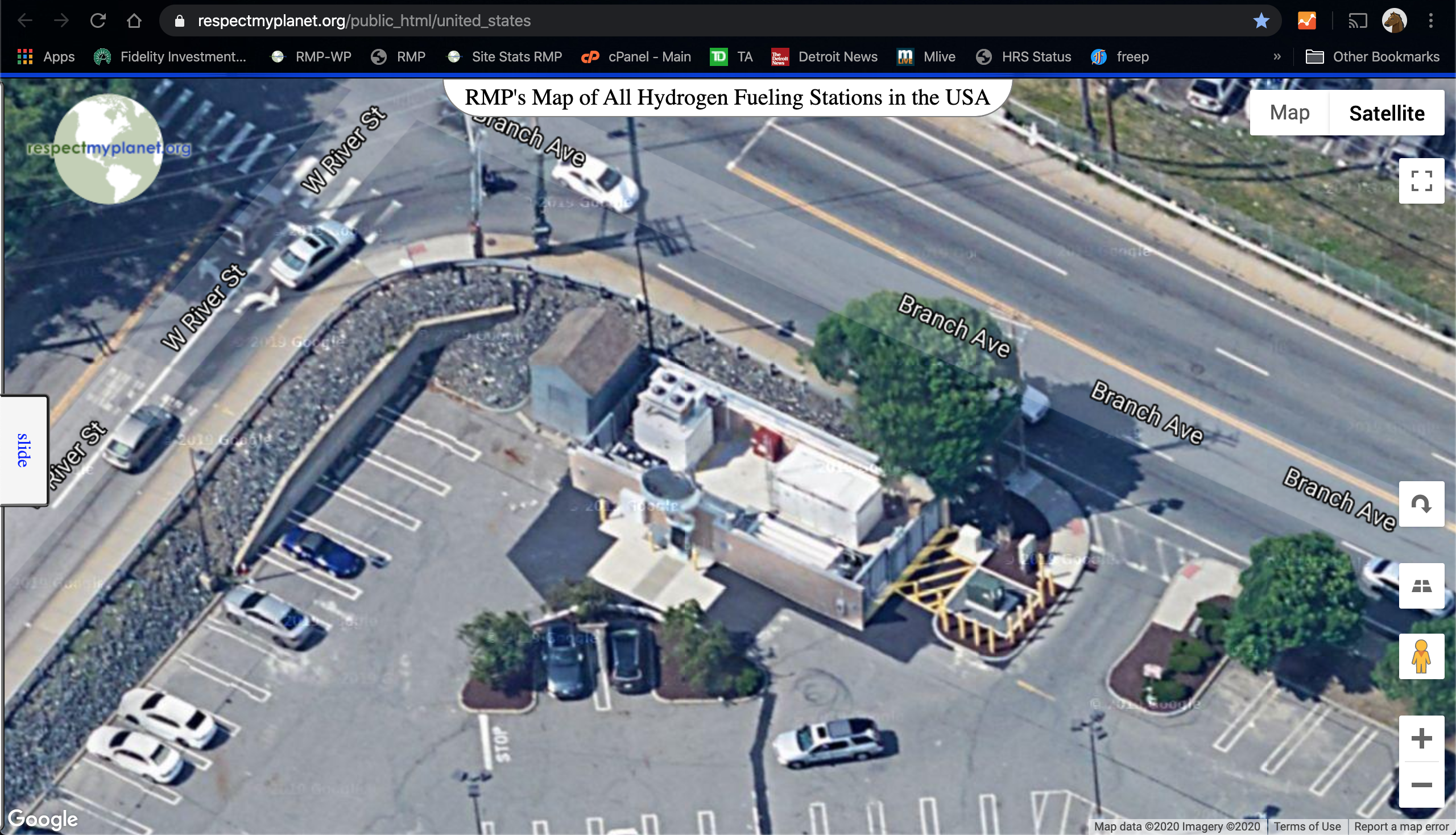
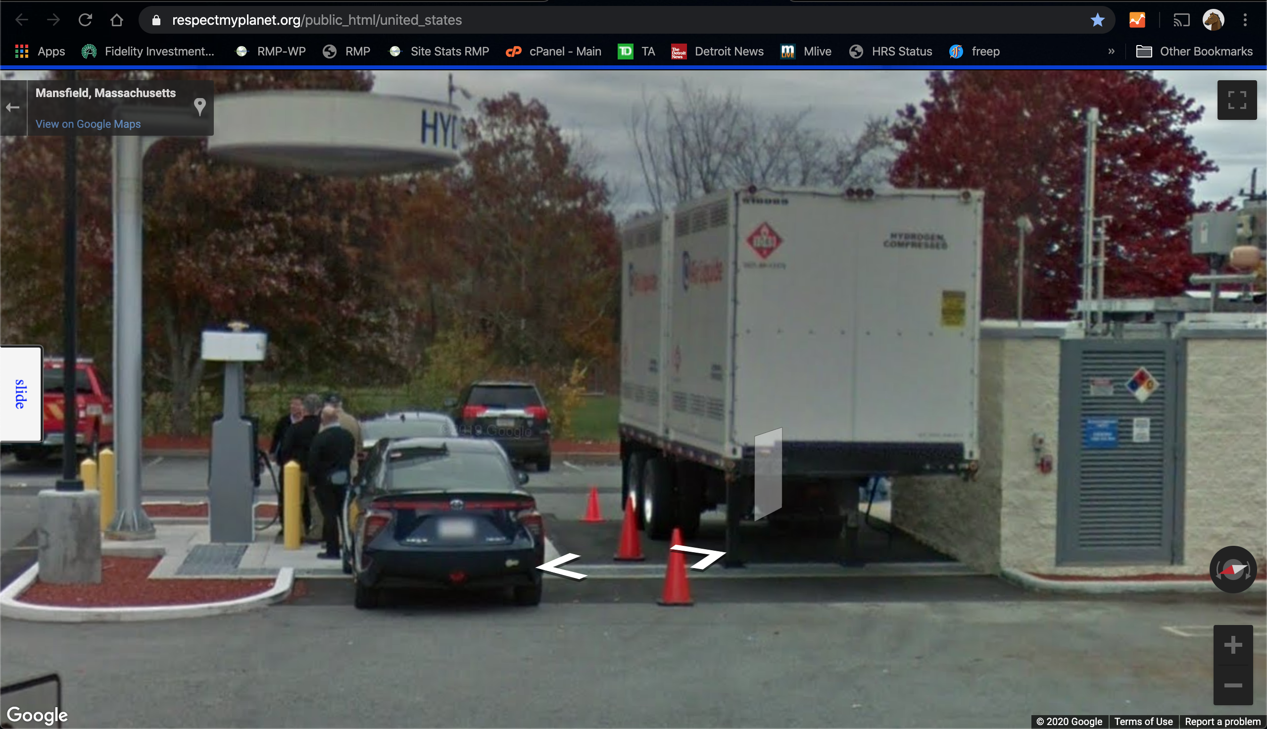
Going to be some cool new features coming soon, so please check back as RMP makes our map cooler & cooler. As an FYI too, through all this work I was looking at the Air Liquide stations being built on the Eastern Seaboard and I can tell you they all look to be in the commissioning phase so the USA is going to be rolling H2 all up and down America’s newest hydrogen highway. Check out all these pics below from Google Street view of Air Liquide stations in New York, Massachusetts, Connecticut, and Rhode Island. All the stations are, it looks like, ready soon.


So, that’s it for this short post. Just wanted to share all the information I found as I have been working on this Making Maps Great Again project. I look forward to updating a ton of cool new features to help you find what you’re looking for if you’re an energy explorer too.
Thanks for reading & check back soon, hydrogen updates are happening fast now. Air Liquide has quietly been kicking some serious ass & dropping some serious cash on America’s East Coast. Look for the East Coast hydrogen highway to be opening soon!

There is a red spooge in San Bernadino.
Zoom in on that Red spooge 😃. It’s the exact route of the Redlands Passenger Rail Project that is under construction & will be the first 9 miles of #hydrogen rail in the USA.