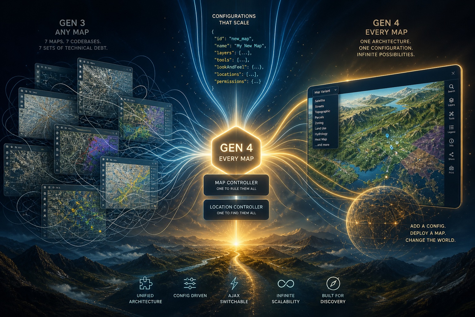
Spring 2026 – RMP’s mapping application is fundamentally changed with the release of our 4th generation version of software. Maps and location homepages are now configured as ‘DNA-like’ instructions for a single map controller and a single location controller. A routing system determines the map or location homepage to render by matching the URL segments to the configuration libraries. This will allow RMP’s map library to scale easily by simply adding new datasets and configurations with no need to write any code. Limited coding resources (i.e. only me night coding after working 50 hours/week at the day job) can now be allocated to feature improvements rather than technical debt.
While some pages & systems keep their old URLs (and may be migrated later), the main change made is to institute a routing system for scalar growth. The new routing system uses the URL segments to call up a map. The base url https://www.respectmyplanet.org/ + /{data-group}/{geographic-region}/{map-variant}/ becomes the DNA strand the routing will use to render the correct map. This means our hydrogen infrastructure map gets a new URL with segments: /hydrogen/north-america/infrastructure/. And while we do not have a european hydrogen map yet, we could easily add that data set & configuration later as /hyrogen/europe/ or /hydrogen/china.
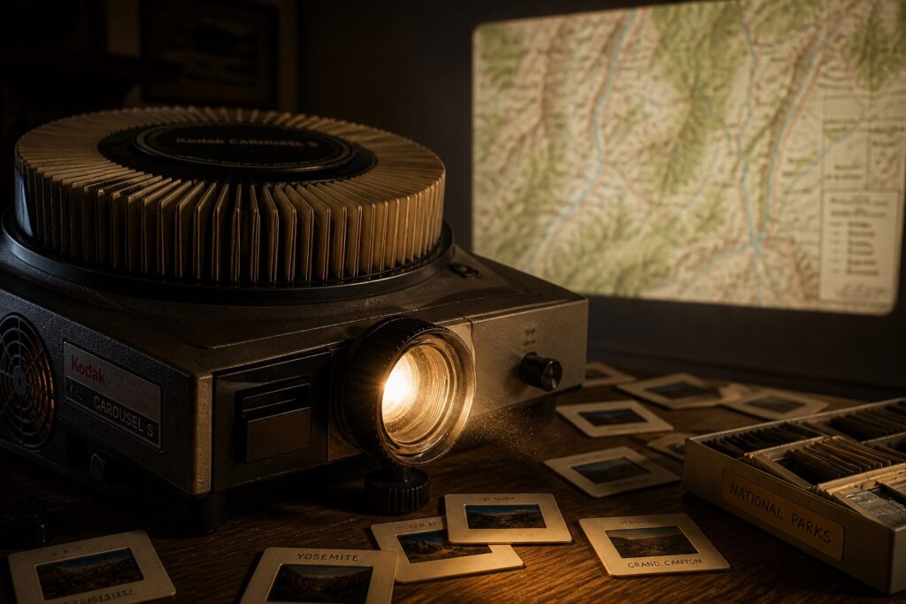
Our Lithium-ion battery map is the first map to have a variant. It’s new routing is /lithium-ion-battery/north-america/supply-chain. From the control panel, you can switch from ‘/supply-chain’ variant to the ‘/lithium-mining’ variant without reloading the page. That 2nd map variant is just an example of all lithium mines by mining method. But we can have ‘/nickel-mining’, ‘/key-recycling-facilities’, ‘/gigawatt-scale-pack-assembly-plants’ or whatever we can dream up. The number of variants available is unlimited except for practicality. This ability to scale our map library is a huge level up in our ability to make new maps. Not only that, the code base has actually shrunk. And not just shrunk, but shrunk by an order of magnitude. Instead of each map suffocating the old software in technical debt, a new map is just a tiny config. Think of your dad’s old slide projector. RMP’s 4th generation software is the same concept as that projector. We’ve built the projector and now all we have to do is drop in new slides to see new maps.
Map URL’s Have Changed – Bookmarks Should Be Updated
RMP’s 4th generation Michigan made software has a new URL structure. Map urls will be changing per the following:
Hydrogen North America Infrastructure Map:
Old URL – https://www.respectmyplanet.org/united_states
New URL: https://www.respectmyplanet.org/hydrogen/north-america/infrastructure
Lithium-ion Battery Supply Chain Map:
Old URL – https://www.respectmyplanet.org/lithium_ion_battery_supply_chain
New URL: https://www.respectmyplanet.org/lithium-ion-battery/north-america/supply-chain
New Variant – https://www.respectmyplanet.org/lithium-ion-battery/north-america/lithium-mining
Global LNG Terminals Map:
Old URL – https://www.respectmyplanet.org/international
New URL: https://www.respectmyplanet.org/lng/global/terminals
Ann Arbor Dioxane 1,4 Plume Map:
Old URL – https://www.respectmyplanet.org/mi_09_ann_arbor
New URL: https://www.respectmyplanet.org/ann-arbor-dioxane-plume/michigan/overview
What Has Not Changed
The California real time hydrogen refueling status pages are still at their original URLs and operate on the old controllers. These pages have not changed and have not migrated yet:
https://www.respectmyplanet.org/california – Overview of all California hydrogen real time statuses by region as reported by the SOSS server with a ping every 15 minutes.
https://www.respectmyplanet.org/california/h2_status_regional/greater_los_angeles – Detailed listing of stations in the Los Angeles region. Other regions like San Francisco Bay, San Joaquin Valley, et cetera are all the same as well.
https://www.respectmyplanet.org/california/soss_location_homepage/168373 – Real time pages like this one for the Baldwin Park station remain the same too as well as all 53 stations reporting real time SOSS in California.
California pages will migrate to the new architecture in the future, but their uniqueness, makes that migration a later priority for 2026 or possibly 2027.
New Location Homepage URLs
Location homepage URLs are now connected to their /{data-group}/{geographic-region}/. This means when you click a marker on the /hydrogen/north-america/infrastructure map, you will open a location homepage with a URL like: https://www.respectmyplanet.org/hydrogen/north-america/mtd-champaign-urbana-bus-1000267
All location homepage URLs for all maps now become:
Base URL + /{data-group}/{geographic-region}/ + URL_slug + Location id#
Again, this is a huge upgrade for the application in terms of scaling. Now we will be able to add a new feature to a single “Location Controller” and every location homepage (literally thousands right now and soon to be tens of thousands of pages) will inherit that feature instantly. If I add an image gallery feature, every single page gets to use it. Add a new line graph or bar graph feature, every page gets access to it. Whether it’s a Dioxane 1,4 Sampling Data line graph tracking remediation in Ann Arbor or Liquified Natural Gas shipment history graphed for Cheniere’s Sabine Pass terminal, it has access to the feature.
Switching Map Variants from the Map Control Panel – The Needle & the Haystack
At the time of this posting and the launch of this 4th generation of our software application, there is only one map variant. The Lithium-ion Battery North America dataset (based on the NAATBatt database) has a variant called ‘lithium-mines’ which is the same map I wrote about here at it’s introduction. The difference now is that this same map is being served from our new scalable software architecture and demonstrates RMP’s new super power: The Needle & The Haystack.
Our datasets are rich. Our tables based on the NAATBatt database are a good example, the amount of data from NREL massive + RMP additional supplemental data piggy backs the NAATBatt tables; it’s the haystack. That heavy data mass provides context for all lithium-ion battery infrastructure in North America. Our Lithium Mining map variant is a needle; our first needle in this haystack. It narrows & distills the data down to 32 key lithium mining locations. This powerful filtering and querying is now easy. Just write a new SQL query and see a new meaningful angle into the rich dataset. We can see nickel mines, graphite mines, electrode cell manufacturing, etc. The sky is the limit. By the time you read this, there may be five new variants or ten or more. They’re now easy add to the library. This can be done on any data set…. every data set. This is the power of coding to scale. This new software architecture changes everything.
Additional Enhancements
The new architecture improves speed and scalability for sure. But under the hood, security has been enhanced in every area to protect against hackers. Application files are not in the public domain. Apache security at the root blocks basic malicious bots. All data going into and more importantly coming out of the database is sanitized to block the most common hacking attempts. Cross site request forgery is blocked with every single form sending uncrackable hash codes that must be verified on the other side. Only predefined domains are allowed to serve pages. Our security is strong on a low budget. Thanks to free AI services like Google Gemini, even self-taught programmers can harden their stack with legit enterprise level security at every layer in the stack. If hackers ever penetrate our security, our app can respawn like a new life in a video game at a cleansed web root.
We look forward to allowing the general public to create user names in safe and secure way. Our goal is to attract volunteers who care about sustainable energy to help our data sets grow by adding additional meta data to our tables. We want those users to know, their interaction with our site is safe, secure, and always through a valid SSL certificate.
Final Thoughts
For RMP, this marks a major milestone in the evolution of our GIS application. We have PFAS contamination data from Wurtsmith Air Force Base that deserves an interactive map. We have Detroit River sediment contamination data, Michigan landfill data, critical minerals data, and much more. Our generation 3 software could build any map. Our generation 4 software lets us build every map.
In software architecture, developers call it “technical debt.” For RMP, managing seven complex maps meant fixing problems across seven controllers, seven models, and seven views. The maps worked, but the foundation could not scale. That foundation is now rebuilt. The next phase is the exciting part: producing feature-rich maps at scale backed by rich, searchable datasets.
If you’ve used government mapping systems for oil wells, mineral deposits from the United States Geological Survey, or EV chargers through the Alternative Fuels Data Center, you know the experience. We call them “haystack maps.” They are slow, bloated, and rigid. Zoom in one level and you wait seconds for the map to re-render while your browser struggles through oversized data payloads.
RMP’s mapping software is fundamentally different from bloated government GIS systems like ArcGIS. Our maps focus on finding the needle in the haystack. Take the National Renewable Energy Laboratory NAATBatt database as an example. We reshape, heal, standardize, and optimize the data so it contains what a modern interactive map actually needs. We remove malformed records, normalize datasets, and add key SQL hooks for advanced searches.
The result is speed and flexibility. You can instantly render the full “haystack” while filtering the data through meaningful supply-chain categories. But the real power goes deeper: every record gets its own feature-rich homepage. Every piece of metadata becomes searchable and connected to advanced SQL-driven insights.
From one database, RMP can generate dozens of meaningful map variants. Government haystack maps cannot answer questions like: “Who are the real players in this industry?” RMP can. That is the query we care about because that is what people actually want to know.
One of the next variants on our NAATBatt map will highlight the top-tier players in North America’s lithium-ion supply chain. The architecture and data hooks are already in place. RMP can surface insights you simply will not find anywhere else — even in premium industry subscriptions.
We look forward to demonstrating the scaling power of our GIS platform and showing users how deep the rabbit hole goes. Whether your interest is global energy infrastructure, industrial pollution, groundwater remediation, or the future of critical minerals and battery supply chains, RMP’s maps are built to help you explore the systems shaping the modern world.
Please Consider a Tax Deductible Donation in the USA
You can make the appeal feel a little more confident and mission-driven while still preserving the humble, grassroots reality of RMP. Right now, some of the wording unintentionally emphasizes scarcity more than impact. Here’s a tighter version that keeps your authenticity but frames the organization as something worth joining rather than rescuing:
RMP is a Michigan-registered US 501(c)(3) organization built almost entirely through volunteer effort and personal investment. Everything you see on this website — every map, dataset, article, and software upgrade — was created with essentially no operating revenue.
Over the past 17 years, we’ve received a handful of reader donations along with early community support from HopCat in 2013. Those contributions have always meant a great deal to us, even though they only cover a fraction of the costs required to operate and expand the platform.
Today, RMP’s software has reached a new level. Our next phase is scaling a powerful GIS platform focused on energy infrastructure, industrial pollution, groundwater protection, and critical mineral supply chains. We believe these tools can become valuable resources for researchers, analysts, students, policymakers, and the public.
If your company is interested in supporting independent data-driven environmental and energy research, we would welcome the opportunity to partner with you. As our map library grows and our visibility expands through search and research communities, sponsorship opportunities and branded partnerships will grow alongside it.
If you value what we are building, please consider making a donation to help us continue growing. Your support helps us advocate for sustainable energy development, protect freshwater resources, and build accessible mapping tools that help people better understand the industrial systems shaping our world.
Thank you for being part of the journey.
Leave a Reply