Videos Related To This Map:
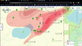
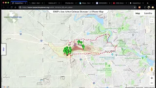
Epicenter of Ann Arbor Dioxane 1,4 Contamination Plume
Short soundless video demonstrating how to use RMP's interactive map to zoom in and see the treatment ponds where the Gelman 1,4 Dioxane plume was started. Follow these same steps yourself by launching the map. Once you learn to navigate RMP's maps, you'll be hooked.
Publish Date: Feb 26, 2020
Duration: 1:09